The Boundary Hunter Story
Our Beginnings - Trusted Surveyors Since 2003
Founded in 2003 by Bruce Smith, Boundary Hunter Limited has become Whangarei’s trusted name in land surveying. Built on a foundation of precision, innovation, and honesty, our mission is to deliver survey results that are accurate, reliable, and easy to understand.
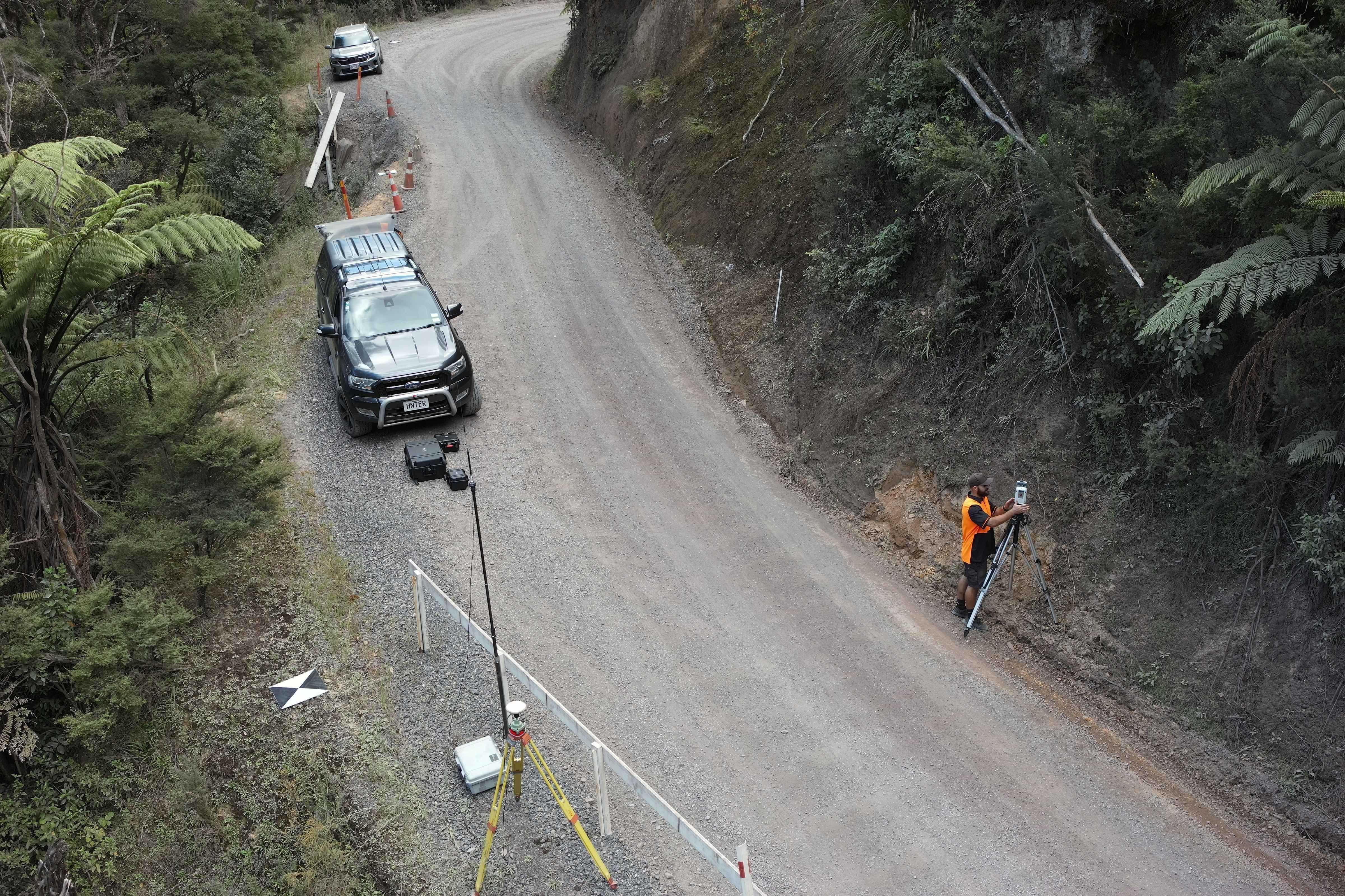
From a single boundary peg to large construction projects, we’ve grown with Northland, evolving our methods and embracing the latest technology, including 3D laser scanning, LiDAR, and aerial photogrammetry. Our SiteWise certification reflects our ongoing commitment to safety and best practice.
We’re proud to partner with local councils, developers, construction firms, engineers, architects, and private landowners, providing tailored solutions that bring projects to life with efficiency and precision.
With over 20 years of experience, Boundary Hunter is more than a survey company — we’re a reliable partner, trusted by Whangarei’s leading organisations to deliver professional results, every time.
Innovative surveying solutions
Since 2003, Boundary Hunter Limited has been Whangarei’s trusted choice for land surveying. Using advanced 3D laser scanning, aerial photogrammetry, and LiDAR technology, we deliver precise results for projects of all sizes — from small plots to expansive developments. Based in Whangarei, New Zealand, our commitment to accuracy and innovation has been the foundation of our work for over 20 years. Rely on us for dependable, cutting-edge surveying services every time.
Safety Commitment
Safety is paramount - Boundary Hunter Limited is SiteWise certifed
Results Focus
Excellence is our standard — Boundary Hunter Limited delivers outstanding results
Innovation & Technology
We embrace the latest technologies, continually evolving to deliver superior service
Why trust Boundary Hunter?
For over 20 years, we've combined honesty, expertise, and innovation to deliver reliable surveying solutions across Whangarei and beyond.
Tailored solutions
We understand every project is unique. Our team deliver tailored solutions for your site, turning your vision into reality with efficiency and precision.
Precision and reliability
Providing Whangarei’s most reliable and technologically advanced surveying services.
Our expertise in 3D laser scanning, LiDAR, and aerial photogrammetry ensures that every project, large or small, is handled with meticulous care and professional excellence.
Clients & Partnerships
Boundary Hunter Limited is proud to work with a wide range of clients across Whangarei and the wider Northland region. From large-scale developments to private property projects, our expertise ensures every client receives precise, reliable, and easy-to-understand survey solutions.
Local Councils – Providing accurate data and compliance-ready plans for infrastructure and community projects.
Housing Companies & Developers – Supporting residential builds, land developments, and multi-lot projects with precision surveying.
Construction Firms – Delivering set-out surveys, as-builts, and progress checks to keep projects on track.
Engineers & Architects – Supplying detailed topographical and 3D survey data for effective design and planning.
Private Landowners – Offering trusted advice and clear plans for boundary marking, site development, and property improvements.
Our strong partnerships reflect our commitment to quality, innovation, and community. Whangarei’s leading organisations continue to rely on us for expert site assessment and professional surveying services.
Contact Us
Office
09 4355387
Unit B4, 7-11 Nell Place
Raumanga
Whangarei 0110
Bruce Smith
027 2260 665
bruce@boundaryhunter.co.nz
Tom Pymar
021 2290 038
tom@boundaryhunter.co.nz
Send a message