Land Surveying Services in Whangarei & Northland

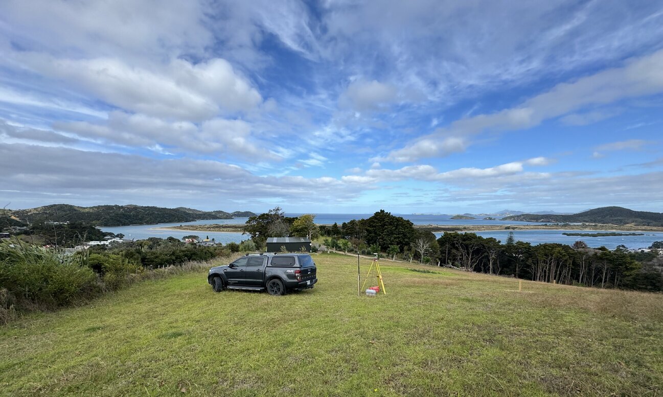
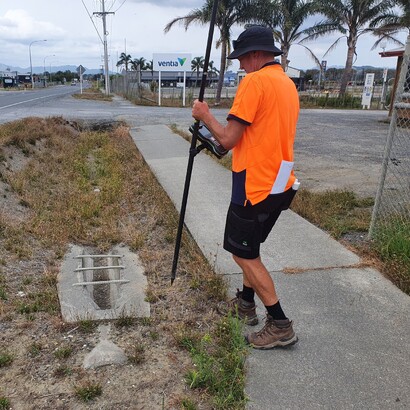
Topographical Surveys - Mapping Terrain & Features
A topographical survey provides a detailed record of both natural and man-made features within a land area. These surveys map elements such as buildings, roads, trees, rivers, ground levels, and utility systems. Using advanced tools including GPS, drones, and 3D scanners, we capture accurate data and present it on topographic maps with contour lines to illustrate elevation changes.
Topographical surveys are essential for construction, engineering, architecture, and land development, giving a clear understanding of the terrain before building begins.
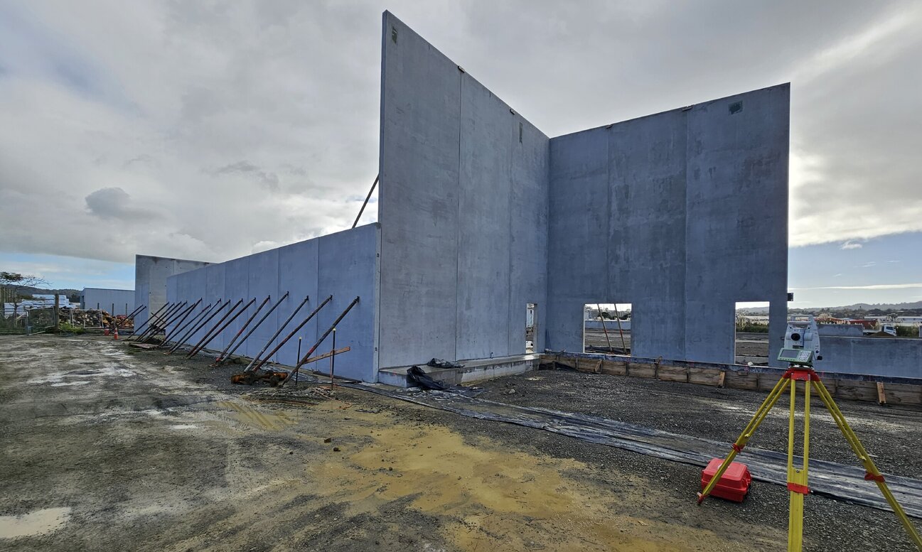
Set Out Surveys - Precision for Construction Projects
A set-out survey, also known as construction staking, is a precise method used to mark the exact locations for new buildings and structures. It translates design plans into accurate ground positions, defining points, boundaries, and levels with precision.
Using advanced equipment such as total stations, GPS, and laser levels, set-out surveys ensure accuracy at every stage of construction. They are vital in the early phases of a project to prevent costly mistakes, maintain compliance with regulations, and ensure the build matches the approved plans. By guaranteeing correct positioning and dimensions, set-out surveys support efficient, successful project outcomes.
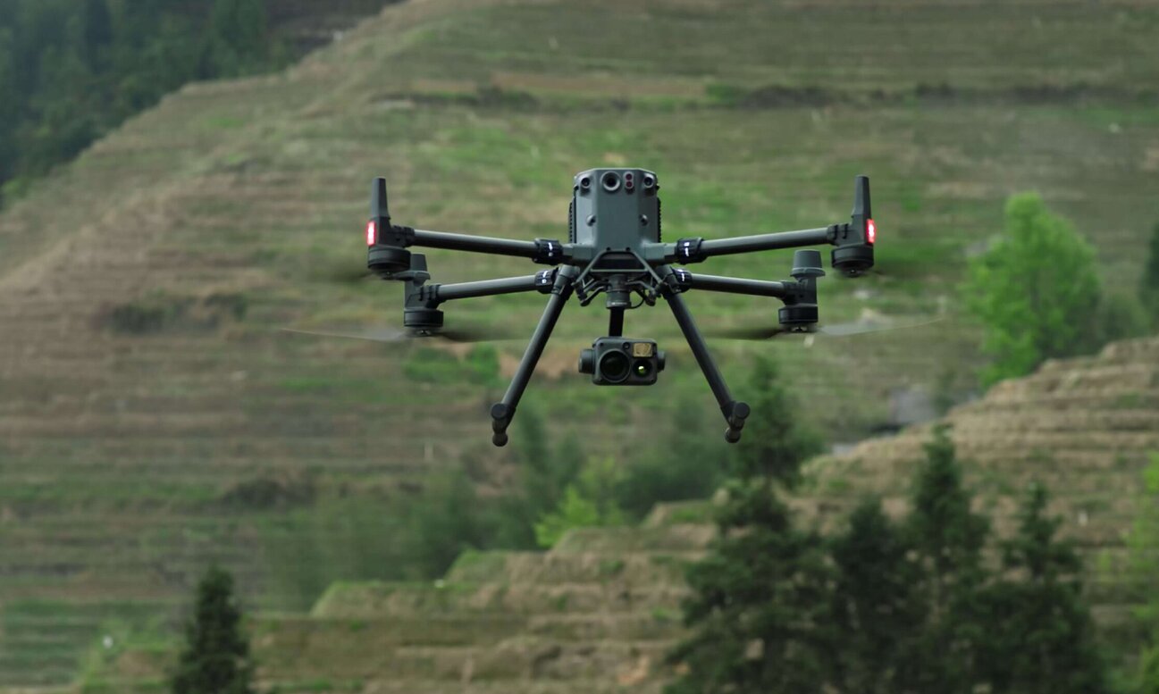
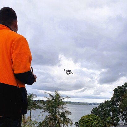
Aerial Drone Surveys - Fast & Cost-Effective Mapping
A drone aerial survey uses unmanned aerial vehicles (UAVs) equipped with high-resolution cameras and sensors to capture detailed images and data from above. This method is fast, cost-effective, and ideal for covering large or hard-to-reach areas.
Drone surveys provide high-quality images, videos, and geospatial data, enabling the creation of orthophotos, digital surface models, contour maps, and 3D models. With GPS and advanced sensors, data collection is both precise and efficient.
By reducing time, cost, and safety risks compared to traditional methods, drone aerial surveys deliver smart, modern solutions for a wide range of industries.
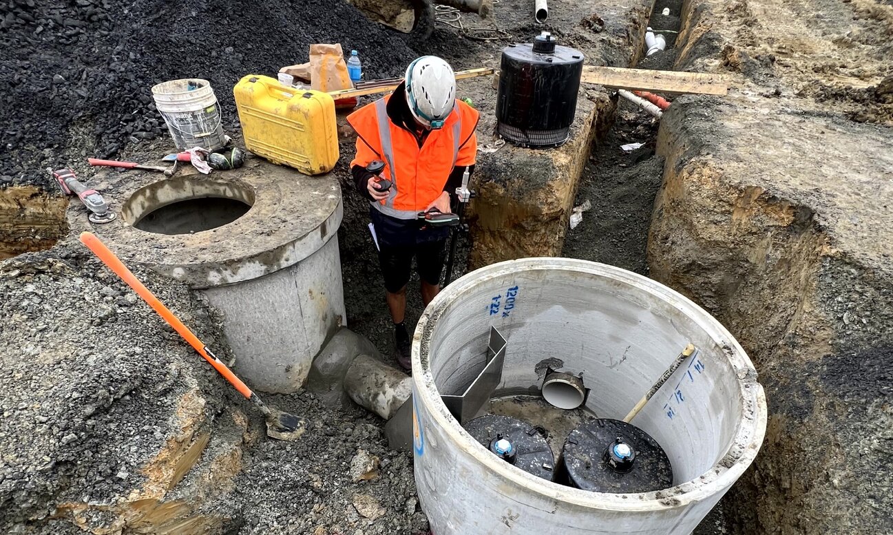
As-Built Surveys - Recording Completed Works
An as-built survey is carried out at the completion of construction to record the precise location, size, and form of the finished project. It compares the completed works against the original design plans, confirming the position and elevation of structures such as buildings, roads, and utilities.
These surveys document any modifications made during construction and produce updated maps or 3D models. As-built surveys are essential for ensuring compliance with regulations and provide an accurate record for future maintenance, redevelopment, or expansion. They are a vital resource for property owners, engineers, and builders to manage the long-term lifecycle of a project.
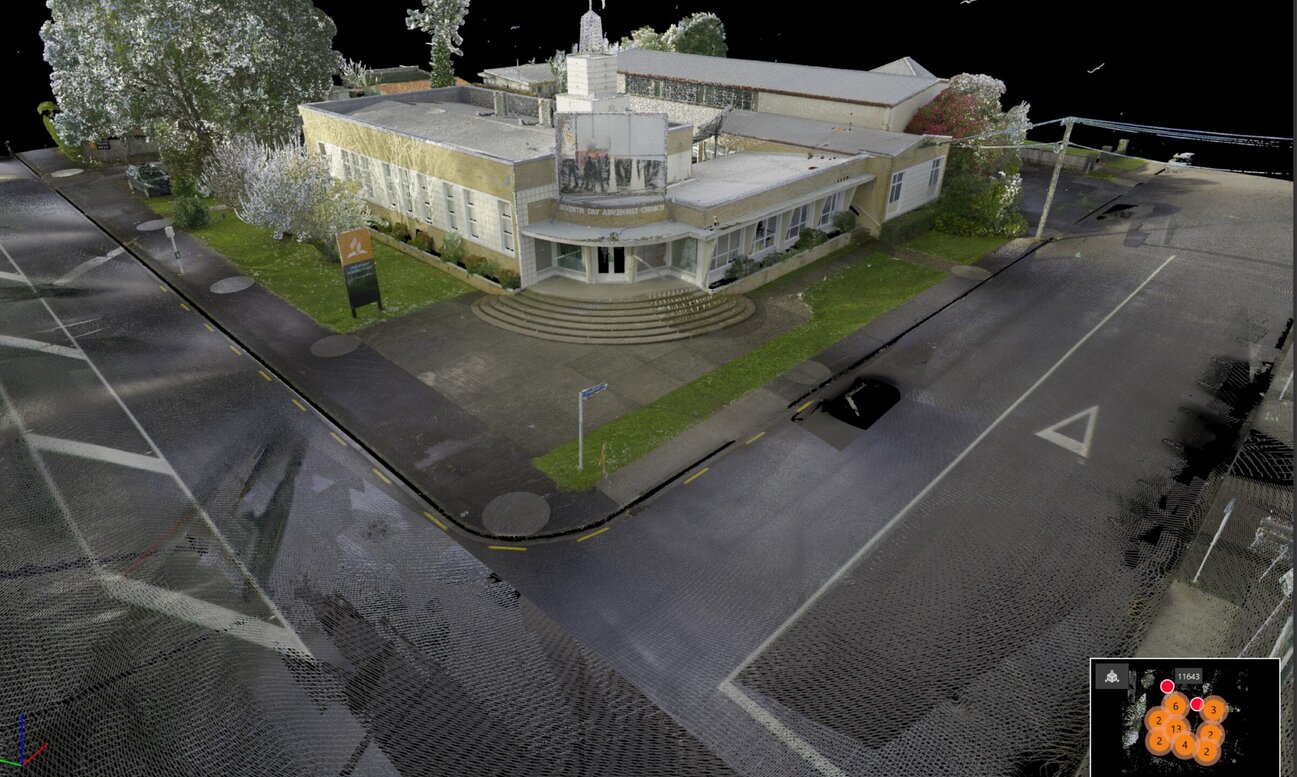
3D Laser Scanning Surveys - Advanced Data Capture
3D LiDAR scanning uses laser technology to capture highly detailed, three-dimensional data of environments. By measuring distances with laser beams that reflect off surfaces, it generates precise ‘point clouds’ that reveal the shape and location of objects, buildings, and landscapes.
This data is used to create accurate 3D models and maps for design, planning, and analysis. At Boundary Hunter Limited, we apply 3D LiDAR scanning across a wide range of industries, including architecture, engineering, and construction projects.
By providing a precise view of existing conditions, this technology supports fast, informed decision-making while reducing the risk of errors in planning and construction.
Trusted land survey solutions
Boundary Hunter Limited has been the go-to experts for Whangarei land surveying since 2003. Our precise and friendly approach ensures every project is done right, from single boundary peg updates to large constructions.
Innovative surveying technology
Whangarei’s trusted surveyors since 2003. Using 3D laser scanning, LiDAR, and aerial photogrammetry, we deliver precise results for projects of all sizes. Accuracy, innovation, and reliability — turning your vision into reality.
Surveying solutions that exceed expectations
Boundary Hunter Limited is committed to innovation, continually evolving our methods to provide the most effective and precise surveying services in Whangarei.
Customised survey solutions for every project
At Boundary Hunter Limited, each project's uniqueness is our challenge. We provide tailored solutions for all survey types, ensuring a stress-free experience.
Contact Us
Office
09 4355387
Unit B4, 7-11 Nell Place
Raumanga
Whangarei 0110
Bruce Smith
027 2260 665
bruce@boundaryhunter.co.nz
Tom Pymar
021 2290 038
tom@boundaryhunter.co.nz
Send a message